consent_cookie
Duración: 1 year
Stores the user's cookie consent state
12-12-2014
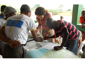
A team of Humana is working on community mapping of Cabinda in which we developed a Farmers Club in order that the population has a tool to help you decide on the use of local resources.
Cabinda is one of the eighteen provinces of Angola, but is separated from the mainland by the neighboring Democratic Republic of Congo, which surrounds the east and south. This small exclave produces 60% of national exports of petroleum; it is the second largest producer in all of Africa, after Nigeria.
But despite this wealth of natural resources, Cabinda remains, however, one of the poorest provinces.
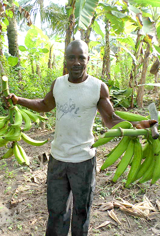
In early 2013, Humana and its local partner ADPP-Angola started in Cabinda a Farmers' Club project, funded by the European Union, 25% expect to increase the productivity levels of their crops. In total, 20 clubs have been established farmers, whose members are mostly women (77% of a total of 1,170), which has led to increased participation in issues affecting the whole community.
Accordingly, encourages their leadership and representation of women in decision-making bodies, often relegated to the domestic sphere.
Besides better organized to leverage resources and access to various local markets, farmers have been trained in techniques more sustainable and efficient farming. Thanks to the project, have also been improved irrigation systems, has promoted the diversification of crops and agricultural tools have been distributed among members. Among the advances that include farmers participating clubs are improving their diet based on local and higher nutritional content products, and increased productivity through sustainable techniques that care both land and culture.
Community mapping
The project also seeks to promote community organization, promoting networks and relationships with local institutions. Humana is currently working with the people involved in the project in identifying key community locations. The goal is to build a map as a tool for documentation and useful to the local population.
At the same time we are identifying community assets and documenting the cultural and historical heritage of the area. The sights have practical value (such as schools and housing), physical (water sources and fields) or cultural (cemeteries and places of worship).
Humana personnel involved in these tasks provides technical assistance and has GPS tools. However, it is the community to decide what to include in the process. The next step will be to integrate the elements identified with satellite imagery to create the map, which will be owned by the community. This map will help them learn and make decisions about the use of community resources. Moreover, given that Cabinda is focus of many multinational companies because of its natural resources, the map will serve in negotiating and evaluating potential infrastructure projects and foreign investment.


